
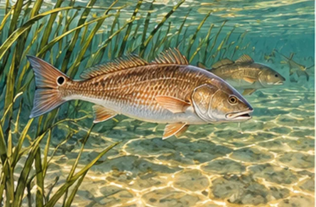
Tides are the regular rise and fall of coastal water. Redfish are a coastal fish also called red drum. As water covers or uncovers a marsh edge, it changes the areas fish can reach and the water you can fish.
A tide table helps you prepare, but it doesn't tell you exactly where a fish will be. Keep the expected station height, a measured station height and your local fishing observation as separate records. Compare their labels and times before using them together; none alone establishes the fish's position or the path your bait will take.
Know which question you're asking
Three things often get called “the tide” in conversation:
- Water height: how high the surface is against a fixed reference level.
- Current: water flowing past a bank or through an opening.
- Bait or lure path: where natural bait—food on a hook—or an artificial lure sits or moves. Anglers may call this the presentation.
They're related, but they answer different questions. The time of high water at a station doesn't tell you exactly when a small marsh passage stops flowing. A water-height number is measured above a reference level; it doesn't measure from the surface to the bottom under your boat.
The tide-height explanation introduces those distinctions if they're new to you.
Read the prediction for your trip
A tide prediction estimates the rise and fall at a named location. Open its table for your trip date. The station is the location the table describes, not every fishing spot in the area. Find the hours covering your arrival through return, then look at whether the predicted surface rises or falls during that period. A high-water time is just one point in that sequence.
Read the labels before using the numbers:
- Units: are heights in feet or meters?
- Time zone: is the table using local time or UTC, a worldwide time standard? Use the table's stated zone or its time-zone option; don't assume it matches your phone.
- Reference level, or datum: what chosen zero level are the heights measured above? That chosen zero is a height reference, not a measurement of the bottom at your fishing spot.
An observation is a water level actually measured at a station and time. Weather and other influences can make it differ from the prediction. Before comparing numbers, match the station, timestamp, units and datum. If those labels don't match, don't subtract the values as though they describe the same thing.
A prediction for a future arrival and the latest measurement from an earlier hour are not a matched pair. Compare prediction and observation at the same station time when assessing their gap, then keep the prediction for the rest of the outing as a separate planning record. Note how recent the measurement is rather than let ‘latest’ stand for the time you intend to fish.
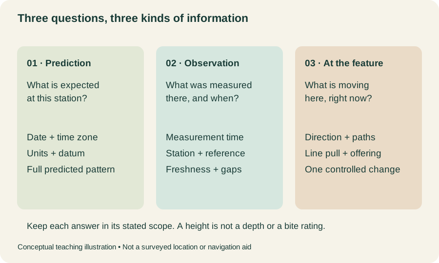 Open the full-size illustration →
Keep those answers separate. A measurement at a coastal station doesn't show every pond or passage nearby. Read the drawing as questions to answer, not a conversion from a station height to local depth or current. The wind-study explanation shows why one retained weather correction cannot replace the separate records.
Look at the actual edge when you arrive
Is water reaching the grass, covering a low bank or leaving exposed mud? Watch naturally floating material to see which way it moves around the feature.
A drain is a passage connecting areas of marsh water. It may carry water differently from what you expected from a nearby tide table. The marsh-drain lesson shows how to observe that connection.
Higher water can cover ground beside an edge; lower water can expose it or change which parts you can reach. Check the place in front of you before repeating a cast from another visit. Neither level guarantees a better bite or tells you the local flow direction. Describe what is visible—covered grass, exposed mud or surface material moving through the opening—and leave bottom depth, subsurface flow and fish identity unresolved where you have not observed them.
Make one useful adjustment
Imagine your notes show a predicted high approaching, but leaves are still moving out of a small marsh passage. Record both. You don't need to erase the local observation to make it agree with the table.
From a fishing position you're allowed to use, make a short cast into clear water beside the edge. Watch the cork—a surface float—or the line. If it drifts into grass, bring it back and try a clearer placement on the next cast. If the flow slows or reverses later, watch again before using the same path.
Keep the rig, the hook-and-line arrangement, the same while comparing one cast change. Inspect the returned bait or lure, joins and any plant material before repeating. Note a changed wind or surface movement too; otherwise a different path may be attributed to the cast when conditions changed as well.
Keep a simple note in three parts:
- Station information: source, station, prediction or measurement time, units, time zone and datum. Keep a future prediction distinct from an earlier measurement.
- Local observation: actual feature and time, covered or exposed edge, visible movement and what remains unseen.
- Fishing attempt: rig, intended path, what the line or float did, returned condition and one change tried.
Retain both the approaching predicted high and the outward-moving leaves in the imagined example; neither needs to be rewritten to match the other. Over several visits, these comparisons are more informative than assigning one ‘best tide’ to every outing. Check weather and access separately, and revisit the affected plan if the return time or fishing place changes.